Mountains are majestic natural formations that have captivated humanity for centuries. Whether you’re an avid hiker, a curious geographer, or simply someone who appreciates the beauty of nature, understanding how mountains are represented on topographic maps can greatly enhance your experience. These maps, which provide a detailed portrayal of the Earth’s surface features, offer a wealth of information for outdoor enthusiasts, scientists, and geologists alike.
In this blog post, we’ll answer some key questions about topographic maps and how they represent mountains. We’ll explore the importance of contour lines, the calculations involved in creating these maps, and the significance of the space between contour lines. Additionally, we’ll delve into the basic features of contour lines and discuss their practical applications. So, whether you’re planning an adventure in the mountains or simply curious about cartography, join us as we uncover the world of topographic maps and their representation of mountains.

How Mountains Take Center Stage on Topographic Maps
Mountains, those majestic giants of nature, play a leading role on topographic maps. These maps provide a detailed portrayal of the Earth’s surface and serve as a valuable resource for hikers, geologists, and cartography enthusiasts. In this section, we’ll delve into how mountains are represented on a topographic map and uncover the fascinating world of contour lines and shaded relief.
Behind the Scenes: Contour Lines
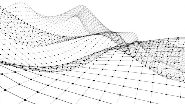
Contour lines are the unsung heroes of topographic maps. They depict the elevation and shape of the land in a way that tickles both the artistic and analytical sides of our brain. These lines gracefully trace the curves and crevices of mountains, enabling us to visualize their height and steepness.
To keep things fun, just imagine contour lines as the Appalachian Trail of maps – they meander, twist, and turn, guiding us on an adventure of discovery. Each contour line represents a specific elevation, just like milestones along a trail. As you ascend a mountain on a topographic map, you’ll encounter contour lines getting closer together, indicating a steeper incline. Conversely, when the lines are farther apart, it’s a sign of a gentler slope.
Shades of Relief: The Artistic Touch
Now, let’s get artsy! Shaded relief adds an extra dimension to topographic maps, giving mountains a lifelike appearance and making them pop off the page. It’s like adding a dash of pizzazz to bring out their rugged beauty.
The magic behind shaded relief lies in the interplay of light and shadow. By simulating the angle of the sun’s rays, cartographers create shadows that mimic the mountains’ three-dimensional shape. So, when you gaze at a topographic map with shaded relief, you can almost feel the mountain’s grandeur reaching out to you, beckoning you to explore.
Conquer the Peaks with Spot Heights
If you’re dreaming of conquering towering peaks like a modern-day Edmund Hillary or Junko Tabei, topographic maps have got your back. With the help of spot heights, you can easily locate the exact elevation of mountain summits.
Spot heights are like the Sherpas of topographic maps – they guide you to the highest point with unwavering precision. These numerical labels, strategically placed at the summit of a mountain, reveal its elevation above sea level. So when you “bag” that mountaintop, you can proudly proclaim your conquest and impress your friends with the precise feet or meters above sea level you’ve ascended.
Take a Bird’s Eye View with Hachure Lines
If contour lines are the main actors, hachure lines are the supporting cast that adds depth and texture to the portrayal of mountains on topographic maps. These short, slanted lines cleverly visualize the steepness of slopes and cliffs.
Imagine hachure lines as the movie extras that transform a scenery into an epic panorama. They are used to illustrate depressions or concave slopes, such as valleys or canyons. By portraying the hachure lines on the contour lines’ downslope side, cartographers ingeniously communicate the shape of the land and provide a bird’s eye view of the mountainous terrain.
So there you have it – a glimpse into the captivating world of how mountains are represented on topographic maps. Contour lines guide us along the undulations, shaded relief adds the artistic flair, spot heights guide the adventurers, and hachure lines provide a birds-eye view of the landscape.
Next time you delve into the intricate details of a topographic map, take a moment to appreciate the careful craftsmanship that brings these mountains to life. It’s a testament to human ingenuity and artistry, capturing the essence of nature’s glorious creations on a piece of paper.
Happy mapping, fellow explorers!
FAQ: How Are Mountains Represented on a Topographic Map?
Question 1: How do you calculate contour lines
Contour lines are not something you calculate using fancy equations or complicated math. They’re actually lines that represent the elevation of a certain area on a map. These lines are drawn by experts who go out into the field and painstakingly measure the elevation of different points using highly accurate tools. So, the next time you see those perfectly curved contour lines on a topographic map, remember that they were created by some dedicated individuals who are really good at using their measuring gadgets.
Question 2: How does a contour map work
Ah, the humble contour map. It’s like a little sneak peek into the world of mountains, valleys, and hills. Contour maps work by using those neat little contour lines we just talked about. These lines connect points of equal elevation, allowing you to visualize the shape and size of the land. The closer together the contour lines are, the steeper the slope. So, if you’re planning a hiking trip in the mountains, don’t forget to consult a contour map to save yourself from unnecessarily huffing and puffing up an impossibly steep hill.
Question 3: What is the use of contour lines
Contour lines may seem like doodles on a piece of paper, but they actually serve some pretty important purposes. They help us understand the shape of the land, identify different landforms like mountains and valleys, and even plan where to build stuff like roads and buildings. So, the next time you’re wondering why contour lines exist, just think of them as the unsung heroes of the cartographic world, quietly helping us navigate through life, one topographic map at a time.
Question 4: What is the interval between contour lines called
Ah, the interval between contour lines. It’s like the cool kid at the contour line party. This space between the lines is called the contour interval. It tells you the difference in elevation between each contour line. A smaller contour interval means the land is changing elevation more rapidly, while a larger interval means a more gradual change. So, when you’re looking at a topographic map and you see those contour lines dancing around, just remember that they’re giving you the inside scoop on the ups and downs of the terrain.
Question 5: What are the basic features of contour lines
Contour lines may look like squiggly lines playing on a map, but they actually have some cool features. Firstly, they never cross each other, because that would just mess up everyone’s navigation game. Secondly, they form closed loops around hilltops or depressions, like nature’s very own contour line hugs. Lastly, they get all giddy when they’re close together, indicating steep slopes, and they spread apart when the slope is more relaxed, like a lazy river on a hot summer day. So, next time you see those quirky contour lines, give them a little nod of appreciation for their cartographic flair.
Question 6: Why do we use contour lines
We use contour lines because they’re like the secret language of the land. They allow us to understand and communicate the shape, elevation, and features of the terrain. From hikers to city planners, contour lines help us make informed decisions, navigate safely, and plan our adventures without unexpected surprises. So, the next time you’re using a map to explore the great outdoors or plan the layout of a new town, remember that those contour lines are the unsung heroes guiding you to success.
Question 7: How are mountains portrayed on a topographic map
Mountains on a topographic map are like the stars of the show. They’re depicted using contour lines that wrap around their majestic peaks. These lines curve around the mountain, often forming concentric circles that showcase the mountain’s varying elevation levels. When you look at these contour lines, you can practically feel the sense of awe and adventure that comes with exploring these towering beauties. So, whether you’re an avid mountaineer or an armchair adventurer, topographic maps have your back when it comes to navigating those scenic mountain ranges.
Question 8: What are two practical applications of contour lines
Contour lines aren’t just fun squiggles on a map; they have some pretty handy applications too. One practical use is in surveying and land development. Architects, engineers, and city planners rely on contour lines to understand the lay of the land, plan infrastructure projects, and ensure everything fits together like a well-orchestrated symphony. Another application is for outdoor enthusiasts like hikers and mountaineers. You can use contour lines to assess the difficulty of a trail, find the best routes up mountains, and avoid any unexpected surprises like bluffing a steep slope. So, whether you’re building the next architectural wonder or embarking on an epic outdoor expedition, contour lines are there to guide you along the way.
That concludes our FAQ section on how mountains are represented on a topographic map. Now that you’re armed with the knowledge of contour lines, go forth and explore the world with confidence!