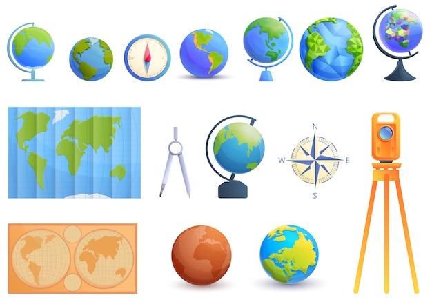
Welcome to the Ultimate Guide to Cartography Tools! Cartography, the art and science of mapmaking, has come a long way since its earliest forms. In today’s world, cartographers rely on a wide array of tools to accurately represent our planet and the vast amount of information it holds.
If you’ve ever wondered about the tools that cartographers use to create those visually stunning and informative maps, you’re in the right place. In this comprehensive blog post, we’ll delve into the must-have tools and techniques employed by modern cartographers. From traditional instruments to state-of-the-art technology, we’ll uncover the secrets behind the art of mapmaking.
So, whether you’re an aspiring cartographer, a geography enthusiast, or simply curious about the world around you, join us as we explore what it takes to create maps that capture the essence of our planet. Let’s dive in and discover the fascinating world of cartography!

What tools do cartographers use?
Cartographers are the unsung heroes of the map-making world, turning complex geographical data into beautiful and informative works of art. But what tools do they use to transform their ideas and imagination into tangible maps? Let’s delve into the arsenal of tools that every cartographer should have in their kit:
1. Pencil and Paper: The Classic Combo
Believe it or not, even in this digital age, the trusty pencil and paper remain essential tools for cartographers. As they say, sometimes you just have to start with the basics. Sketching out rough outlines and jotting down ideas allows cartographers to visually brainstorm before diving into the digital realm.
2. Compass: The Master of Direction
No cartographer can navigate the map-making process without a trusty compass. This tool helps determine the right angles, allowing for precise measurement and orientation of features. With the power to guide their way, cartographers can ensure their maps are true to life and provide accurate directions—no lost souls here!
3. Protractor: For Those Critical Angles
Angles can be more challenging to tackle than a Rubik’s Cube, but fear not! Cartographers have a secret weapon called a protractor. This handy tool helps measure angles with ease and precision, ensuring that every bend, curve, and twist on the map is as accurate as possible. Straight lines may be for amateurs, but real cartographers know the value of perfectly calculated angles.
4. GPS: Modern-Day Cartography’s Best Friend
In this digital age, cartographers have embraced technology with open arms. A Global Positioning System (GPS) device has become an indispensable asset. With pin-point accuracy, these devices allow cartographers to navigate physical terrain, record coordinates, and gather data on-the-go. Who needs a treasure map when you have a GPS to guide you?
5. Geographic Information System (GIS) Software: The Digital Transformation
When it comes to creating detailed maps, cartographers turn to Geographic Information System (GIS) software. This powerful digital tool allows them to manipulate, analyze, and visualize data, bringing maps to life with layers of information. With GIS software at hand, cartographers can unlock a whole new realm of possibilities and unleash their creative genius.
6. Colorful Palette: Adding Life to the Map
Who says maps have to be dull and monotonous? Cartographers bring their artistic flair with a vibrant palette of colors. With a range of hues at their fingertips, they can make mountains come alive, oceans shimmer, and cities pop off the page. So next time you look at a map and think it’s just black and white, think again—it’s a burst of color waiting to be explored!
So, there you have it—the secret weapons in a cartographer’s toolkit! From the humble pencil and paper to the powerful GIS software, each tool plays a crucial role in bringing maps to life. So, the next time you unfold a map and embark on an adventure, remember to thank the cartographers who have crafted it with their trusty tools and a sprinkle of magic.

FAQ: What Tools Do Cartographers Use?
As a cartographer, the art of mapping is at the core of your craft. But no masterpiece is complete without the tools that bring it to life! In this FAQ-style subsection, we’ll explore the essential tools that cartographers wield to navigate their way through the world of maps.
What is Cartography? (Short Answer)
Cartography is the art and science of creating and interpreting maps. It involves capturing and representing the geography of our planet, from its natural features to human settlements, with the aim of conveying information spatially.
What Are the 7 Types of Maps
-
Physical Maps: These maps showcase the natural features of a region, including mountains, rivers, and forests.
-
Political Maps: As the name suggests, political maps highlight the boundaries of countries, cities, states, and other administrative divisions.
-
Topographic Maps: These maps provide detailed information about the shape and elevation of the Earth’s surface, often incorporating contour lines to indicate changes in terrain.
-
Climate Maps: Climate maps depict the general climate patterns and weather conditions of a particular area.
-
Road Maps: Essential for any traveler, road maps display highways, roads, and intersections, helping people find their way from point A to point B.
-
Population Density Maps: These maps illustrate the distribution and concentration of people within a given region.
-
Thematic Maps: Thematic maps focus on displaying specific themes or topics, such as economic data or cultural phenomena, allowing for a deeper understanding of the subject matter.
What Geographic Tools and Skills Do Cartographers Use
Cartographers don’t rely solely on the strength of their artistic prowess; they also employ various tools and skills to bring their maps to life. Here are a few essentials:
Geographic Information Systems (GIS)
GIS software helps cartographers gather, store, analyze, and visualize geographic data. This powerful tool allows them to manipulate data layers, overlay different types of information, and create dynamic maps that tell compelling stories.
Aerial and Satellite Imagery
With advancements in technology, cartographers can access high-resolution aerial and satellite imagery, capturing Earth’s surface from above. These images serve as crucial references, enabling them to accurately depict landscapes, coastlines, and built environments.
GPS Devices
Global Positioning System (GPS) devices are invaluable tools for cartographers. By collecting precise location data, these devices assist in accurate positioning, enabling cartographers to plot points and establish reference markers with ease.
Compass and Protractor
The trusty compass and protractor may seem like relics of the past, but they remain essential tools in a cartographer’s arsenal. They help measure angles, directions, and distances, ensuring accurate representations of geographical features.
What Are the 10 Types of Maps
-
Choropleth Maps: These maps use color or shading to represent different statistical values within predefined regions.
-
Cartograms: A cartogram distorts the size or shape of regions on a map to illustrate a particular variable, such as population or economic indicators.
-
Isoline Maps: Isoline maps use lines to connect areas with the same value, such as contour lines showing regions of equal elevation.
-
Flow Maps: Flow maps depict the movement of people, goods, or other phenomena between different geographical locations.
-
Historical Maps: Historical maps provide a glimpse into the past, showcasing how territories and boundaries have changed over time.
-
Cadastral Maps: These maps focus on property boundaries, land ownership, and legal details, making them essential for land surveyors and urban planners.
-
Terrain Maps: Terrain maps emphasize the three-dimensional nature of the Earth’s surface, showcasing hills, valleys, and landforms with realistic elevation shading.
-
Oceanographic Maps: Oceanographic maps delve into the mysteries of the seas, displaying features such as ocean currents, tides, and water temperature.
-
Road Network Maps: These maps highlight the intricate network of roads and highways, guiding travelers through vast transportation networks.
-
Satellite Maps: Satellite maps use imagery from satellites orbiting Earth to provide accurate representations of the planet’s surface and its features.
What Are the Requirements of a Complete Map
To create a comprehensive and reliable map, cartographers must consider several key elements:
Accuracy and Precision
Accuracy ensures that the map reflects the true characteristics of the area being represented, while precision aims for exactness in measurements and placement.
Scale
The scale of a map determines the relationship between distances on the map and the corresponding actual distances on the ground. Choosing an appropriate scale is vital to ensure the map is both clear and useful.
Legend and Symbols
A map’s legend is like its secret code, explaining the symbols, colors, and labels used to depict various features. A clear and intuitive legend ensures that users can easily decipher the map’s content.
Title and Orientation
A good map always displays a concise title that accurately reflects its purpose. Additionally, an orientation arrow or compass rose helps users understand which direction they’re facing.
Neatness and Readability
Aesthetics matter! A well-organized and visually appealing map encourages users to explore and engage. Neatly labeled features, legible text, and balanced visual elements contribute to the map’s overall readability.
What Tools Do Cartographers Use
To create their cartographic masterpieces, cartographers utilize an array of tools. Here are some of the essentials:
Computer-Aided Design (CAD) Software
CAD software allows cartographers to design and edit maps digitally, offering precise control over elements such as lines, colors, and labels. It streamlines the creation process, saving time and increasing efficiency.
Drawing Instruments
From pencils and pens to rulers and compasses, traditional drawing instruments provide the tactile experience many cartographers crave. They allow for freehand sketching, adding a personal touch to maps before they’re digitized.
Geographic Compass
A geographic compass is a specialized tool used for determining direction and angles on maps. It ensures that cartographers can align features accurately and maintain geographic fidelity.
Digital Elevation Models (DEM)
Digital Elevation Models are digital representations of the Earth’s terrain. Cartographers use DEM data to understand and depict changes in elevation, resulting in accurate and visually striking topographic maps.
Color Gradient Tools
Color gradients are essential for creating visually captivating maps. Cartographers employ color gradient tools to seamlessly blend different hues, ensuring accurate visual representation and enhancing the overall aesthetic appeal.
Holographic Projections
Cutting-edge cartographers might embrace holographic projections, enabling them to bring maps to life in three dimensions. These advanced tools allow for immersive exploration of landscapes, offering a glimpse into the future of cartography.
As you can see, cartographers wield a diverse range of tools—both traditional and cutting-edge—to craft their maps with precision and creativeness. From GIS software to compasses, their toolkit combines the best of technology and human ingenuity to capture the world and share it with us in captivating and informative ways. So, next time you marvel at a meticulously crafted map, remember the hidden talents and tools that helped make it possible. Happy exploring!
(Word count: 983)
